Project Site and Objectives
Project Site
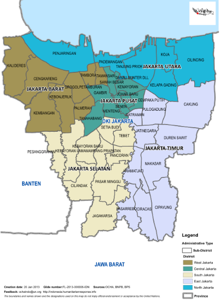
The Special Capital Province Province of Jakarta (662.33 km2)
Project Period
3 Years from May 2018
Objectives
- To establish an action plan to promote countermeasures against land subsidence by implementing some pilot activities.
- To Strengthen capacity for planning and implementing countermeasure against land subsidence in Jakarta.
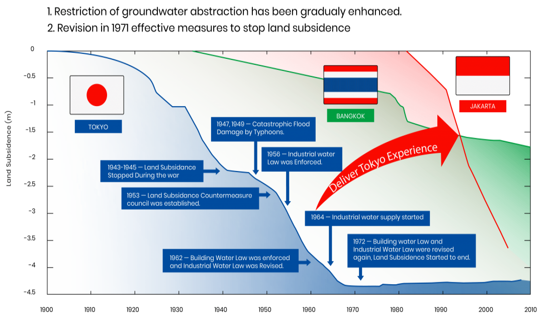
Tokyo Experience
Formulate Task Force
Key Government Organization

BAPPENAS (Ministry of National Development Planning of the Republic of Indonesia)

PUPR (Ministry Of Public Works And Housing)
- DGSDA
- Water Resources Council
- BBWS Ciliwung - Cisadane
- BPIW
- Cipta Karya
- PUSAIR
- Team for NCICD

ESDM (Ministry of Energy and Mineral Resources)
Center for Groundwater Resources and Environmental Geology, Geological Agency

KLHK (Ministry of Environment and Forestry)
- Directorate of Watershed Management Planning and Evaluation, Directorate General of Watershed Management and Protected Forest
- Watershed Management Center Citarum - Ciliwung, Direct General of Watershed Management and Protected Forest

Provgov DKI Jakarta
- BAPPEDA
- Water Resources Office
- Industry and Energy Office
- One Stop Service Agency
- Regional Environmental Management Office
- Jakarta Regional Disaster Management Agency
- Human Settlement, Spatial Planning and Land Office
- Jakarta Local Water Supply Enterprise / Wastewater Management Enterprise

JICA (Japan International Cooperation Agency)
- JICA Project Team ( Consultants Team)
- Representative from JICA Indonesia Office
- JICA Mission Tokyo
- Special Technical Advisor Committee
Other Important Observers :
- Deltares
- Other Relevant Donor Agencies when needed
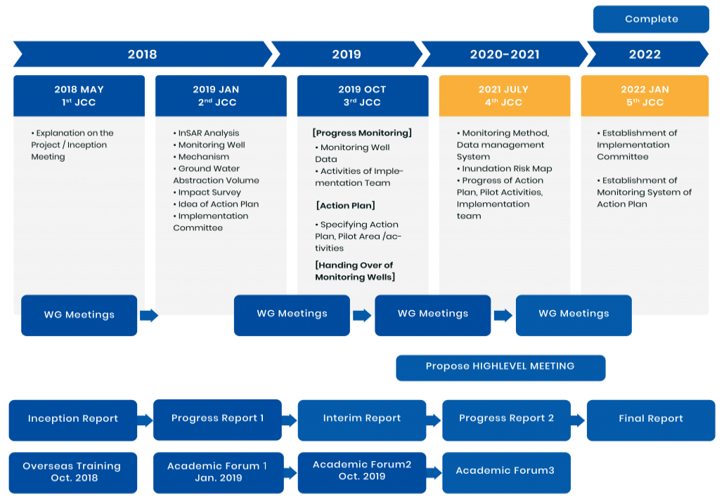
Project Timeline
Stopping Land Subsidence in 2030
1
Complete Monitoring Structure
2
Controlling Adequate Volume of Groundwater Abstraction
3
Developed Alternative Water Resources
(including rain water, recycling urban water)
4
Raise Social Awareness
5
Countermeasure by JICA
Monitoring
- Construct double-tube monitoring well in Cengkareng and Cakung.
- Analyses land subsidence by satellite image InSAR
- Conduct GNSS Survey
Mitigation
- Recommendation letter for activity of inspection of illegal well in Jakarta Barat, Utara and Timur
- Recommendation letter for location of land subsidence which need to be supplied by water. Then the location will be designated for zero deep well area
Adaptation
- Created flood inundation analysis
- Survey of impact and damage of infrastructure due to land subsidence
Social awareness
- Socialization of land subsidence to stakeholder in level City Administrative
- Develop website as dissemination facility for people and stakeholder